Some of our projects

Here is a snapshot of some of the projects we have worked on. For more information about this projects or to talk to us about doing something similar for you, please feel free to contact us

Sustainable Timbers Tasmania

Fuel Moisture Monitoring

Emergency Management #digitalforests Foresty

Sustainable Timbers Tasmania use Fuel Moisture Sticks as part of their Planned Burning Program. Foresters regularly check upon the sticks to use them to measure how wet or dry the fuels are on any given day.

Indicium Dynamics worked with Sustainable Timbers Tasmania to digitise the process using IoT and to develop intuitive ways of interpreting and using the data. This information is used to determine when we will be able to burn the area, or to understand the potential bush fire threat.

This technology was developed as part of a larger #digitalforest strategy, aimed at improving awareness of forest conditions.

dashboard
Parkes Shire Council

Recyled Water Scheme - End User Control System

Smart Cities Smart Utilities Water

In the midst of a crippling drought, Parkes Shire Council commenced an ambitious project to source water for irrigation of public spaces from reclaimed water, rather than using valuable potable water; aiming to save in excess of 600 ML of water a year. The End User Control System (EUCS) was built for Parkes Shire Council to automate the delivery of water to ensure minimal loss and maximum efficiency.

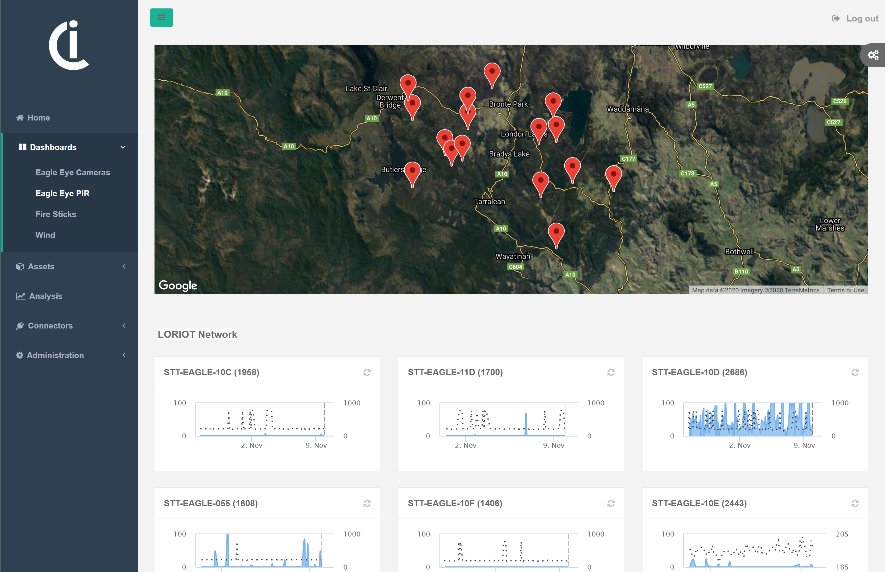
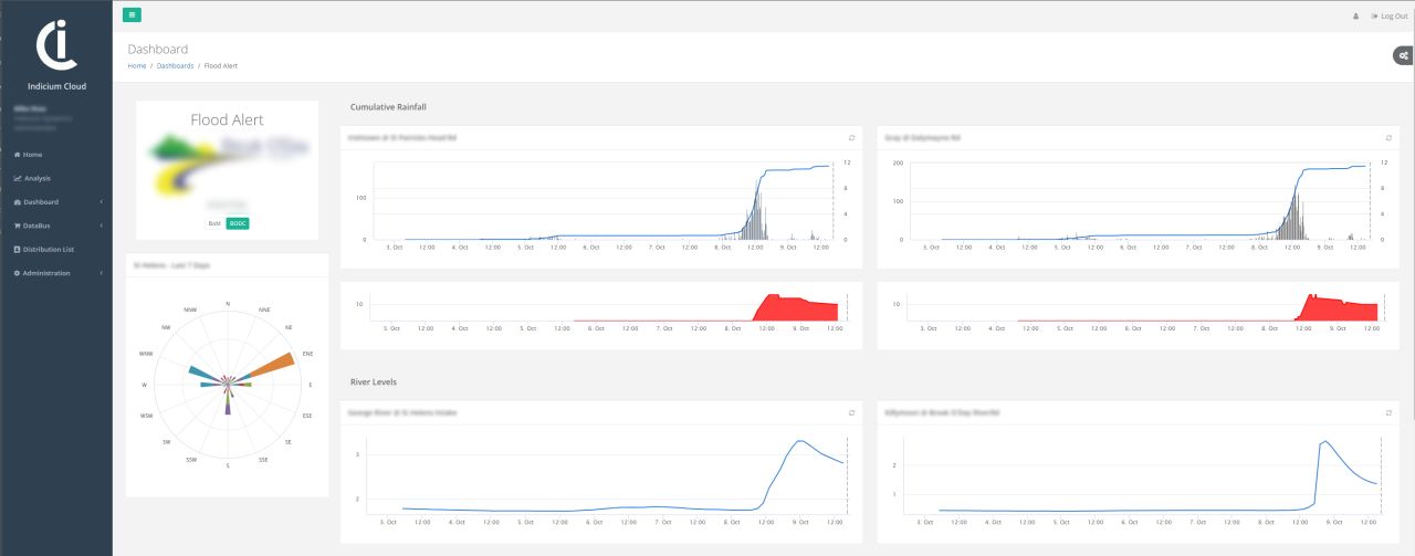
Indicium Dynamics built the EUCS using the INDICIUM DataBus to manage the collection and analysis of data from a variety of sources including water meters, tank levels and the Advanced Water Recycling Facilities SCADA system. The solution leveraged custom built CAT-M1 loggers to read the water meters and control the valves on the pipeline. 
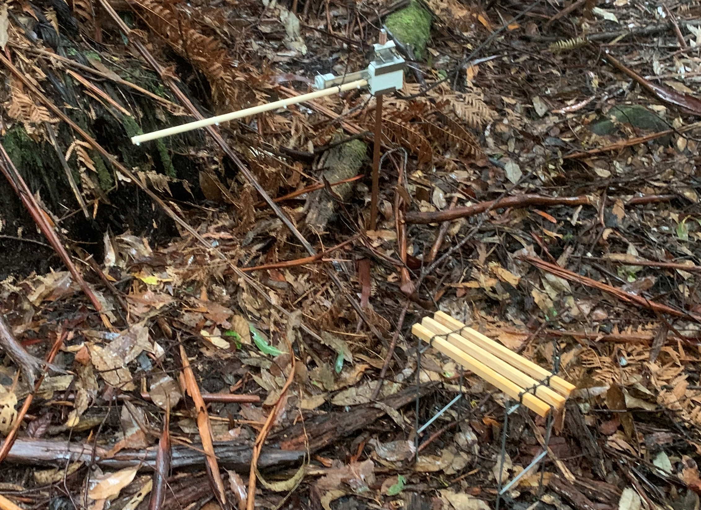
LoRaWAN was used to monitor non-critical inputs such as supply tank levels and dam levels as well as weather data.

The EUCS incorporated many advanced features including automated control of pipe outlets based on usage schedules, water allocations, water quality and weather parameters. For instance, high wind or rain events could result in recycled water forming pools or being blown into sensitive locations like schools or retirement homes. Evapotraspiration levels can be calculated to better understand the amount of watering required, allowing the system to make informed decisions about irrigation schedules and requirements.

Find out more Award Winner!
dashboard
Sustainable Timbers Tasmania

Eagle Eye

Digital Forests Environment

Obtaining and managing high level data for sensitive species is a complex, time consuming and costly task. Manual in-field observations are point-in-time based and can be inconsistent. Creating longer time-series data is very difficult due to irregular or infrequent field observations and can be cost prohibitive.

In the context of forestry and renewable energy production (wind farms etc), knowledge and understanding of eagle nest activity is critical to managing compliance and statutory reporting obligations.

EagleEye utilises IoT technology to safely and easily monitor in-nest activities for large eagles. This creates a rich time series of nest activity that is cheaper, safer and more accurate to collect than traditional management practices.

The INDICIUM DataBus was used to collate data from LoRaWAN sensors and 4G video cameras. This data was analysed to automatically flag which nests were active or not. Machine learning algorithms were also trialed to analyse the captured videos to determine when eagles were detected. This combination of techniques provides for a robust alternative to the manual checks.

Read more Award Winner!
dashboard
Break O'Day Council

St Marys Flood Warning System

Smart Cities Flood Alert Water

St Marys is located in a catchment where high intensity rainfall events can cause flash flooding within a very short timeframe, putting peoples' homes and lives at risk.

Indicium Dynamics have built a flood alert system for Break O'Day Council (BODC) that uses rainfall data and the Australian Rainfall Runoff (ARR) Intensity Frequency Duration (IFD) flood curves to analyse the last 7 days of rainfall to calculate flood probability.

The system is hosted in INDICIUM Cloud where BODC staff can managed SMS and Email distribution lists to keep the public informed of potential flash flood events.

Read more
dashboard
Hydro Tasmania

Flinders Island Renewable Energy HUB

Smart Utilities Energy

Indicium Dynamics developed the Flinders Island Renewable Energy apps and dashboards for Hydro Tasmania in conjunction with Entura.

The apps were developed using Cordova to allow for deployment across multiple platforms, and to allow for simplified sharing of resources between apps and embeddable dashboards.

The data feeds are managed by the Ajenti Data Management System, which is a SaaS IoT platform managed by Entura.

The app is available on both Android and iOS.

Find out more
Loading...

Contact Us

Tasmania
2/3 Abernant Way
Cambridge
TAS 7170

Queensland
3/5 Camballin Crt
Shailer Park
QLD 4128
Send us mail

Or follow us on a social platform

+61 3 6289 8939

Indicium Dynamics Pty. Ltd.

© 2016-2020 Indicium Dynamics